Wednesday, 26 October 2016

Sailing by Hinchenbrook to Orpheus Island

10-11 October 2016

After a week at Dunk Island it was definitely time to get underway again. We had two options. We could go south via the Hinchinbrook Channel  or sail down the seaward side of the island. The plus for the channel was that everyone we have spoken to who has been through it says it’s absolutely beautiful. The negatives we’d been advised of were swarms of mosquitoes and sand flies which make life uncomfortable when anchored at night and the presence of many large crocodiles so no swimming or crabbing as the crocs break pots up to steal the bait.

 
Given it was forecast to be a warm, windless night, the prospect of spending the evening locked below to avoid being eaten alive by bugs wasn’t very appealing so we elected to take the seaward route and make a stop at Zoe Bay on Hinchenbrook Island where we’d read there is a National Parks walk to a waterfall and rock pool. Once more we had a Plan B which involved continuing straight on to Orpheus Island if conditions proved unsuitable at the anchorage in Zoe Bay.

The wind was quite light from the east as we cleared the western end of Dunk Island making progress under sail alone impossible. However, motoring on our course there was just enough apparent wind angle for us to fill the main and stay sails which provided a more comfortable and fuel efficient ride.

We skirted by Bedarra Island to have a look at the now closed Bedarra Hideaway Resort. Rob had done some work there many years ago in its heyday as a very expensive, exclusive resort and was keen to see how it had fared in Cyclone Yazi. The jetty had been washed away but from our distance the buildings all looked to be fine so its non-operational status may have more to do with the economics of changing holiday consumer demand.

Hideaway Resort on Bedara Island appeared to be in reasonable shape.
On the other side of Bedarra Island there are a handful of luxurious private residences. As we made our way past one of the island’s occupants arrived home in his helicopter. What a life.

Note the helicopter parked behind the beach on Bedara Island.

We sailed by many attractive islands between Dunk and Hinchenbrook Islands.
Approaching the northern end of Hinchenbrook Island the true height of its impressive mountains becomes more and more apparent. The Island is a true "wilderness area," wild and rugged with soaring mountainous peaks. Its highest mountain is Mount Bowen, 1121 metres (or 3,678 feet) above sea level. The entire island is a World Heritage listed National Park with internationally renowned walks including the 32 km (20 mi) long Thorsborne Trail along the east coast taking in its varied topography from high peaks to mangrove swamps.

At almost 40,000 hectares, Hinchinbrook is the largest Great Barrier Reef Island.


Hinchinbrook Island's rugged ranges are spectacular to sail past.
 
Unfortunately a reasonably sized easterly swell persisted as we approached Zoe Bay which we decided would make anchoring off its east facing beach quite uncomfortable so we reluctantly elected to activate Plan B and continue past to Orpheus Island.

We watched a sole yacht anchored in Zoe Bay roll heavily in the easterly swell so this was another spot that had to be added to the 'maybe next time list'.
On the way to Orpheus we skirted the western shoreline of Pelorus Island just to its north in a last ditch effort to catch a fish before entering the conservation green zone at Orpheus. True to recent form it was a wasted effort. The fish seem to know where the green zones are. Within moments of us reeling in our lines and entering  the conservation area, the water ahead of the boat boiled with tuna chopping into a school of bait fish much to our frustration.

The sugar loading facility at Lucinda in the distance.
After clearing the southern end of Hinchinbrook Island we sailed past he Lucinda bulk sugar terminal which boasts the longest service jetty in the Southern Hemisphere. At 5.76 kilometres long, supported by more than 660 concrete and steel pylons with its length actually following the curved contour of the earth. Sugar takes 22 minutes to travel along the conveyor from the on-shore storage to the shiploader.
 
We decided to sail along the shoreline of Pelorus Island in the quest to catch dinner.

Pelorus looked very nice but no fish were to be had on this occasion.

There is a private residence tucked amongst the palm trees at the southern tip of Pelorus Island.
We picked up one of the Great Barrier Reef Marine Park moorings in Orpheus Island’s  Pioneer Bay. We rarely use moorings as we prefer to trust our own anchor and chain than wonder what may be hiding under a mooring ball but the GBRMP moorings are very strong and well maintained so we have no hesitation taking advantage of them when available.
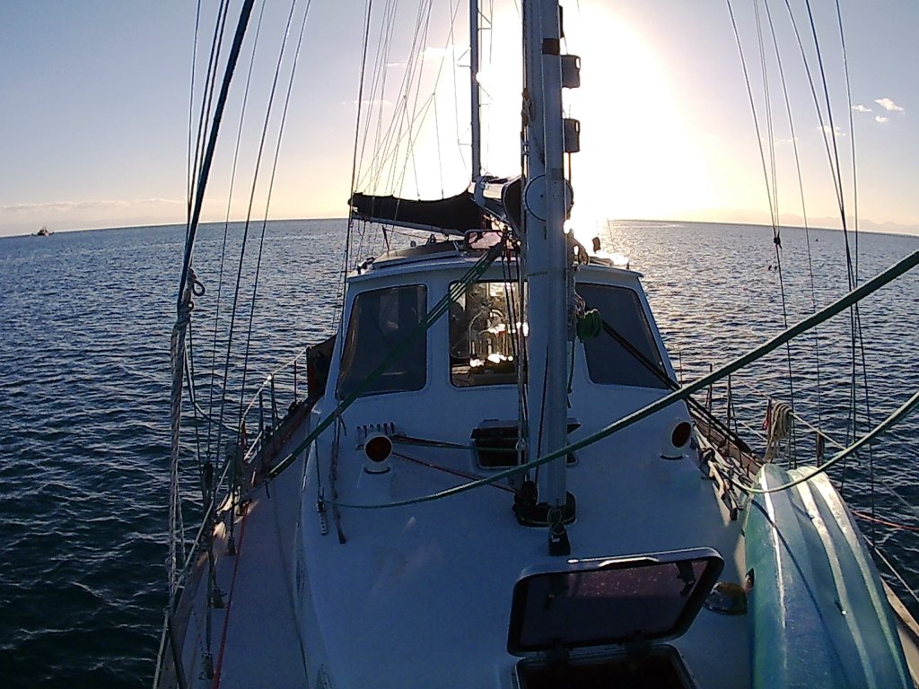
Hanging of a public mooring in Pioneer bay at Orpheus Island.
Dunk Island to Orpheus Island – 46.9 Nautical Miles – 8 Hours 51 Minutes 
Average Speed  5.3 Knots – Max Speed 6.9 Knots


The moon rose over our mizzen mast long before sunset at Orpheus Island.

The wind blew 20 knots from the east the next day so we stayed put and got some exercise paddling all over the bay at low tide having another good look at all the lovely coral, giant clams and fish to be found here. Unfortunately after paddling over to the fantastic reef area packed with an unbelievable concentration of giant clams Rob discovered the memory card was full in the waterproof camera so no photos. Doh!

Have a look at the blog of our previous visit to this beautiful bay to see plenty of above and underwater photos HERE.

 Once again Orpheus turned on a brilliant backdrop for our sundowners that evening.
 

Good night from Orpheus Island.

-----------------------------------------------------------------------------------------------------------------------------------

We love to receive comments on our blog from readers. If you do leave a comment and you also have a blog, please leave a link as well. We'd like to click over for a visit and leave you a comment too.
To stay right up to date with what we’re up to  and see lots more photos check out and 'like' our Dreamtime Sail Facebook page at DreamtimeSail


If you have only recently discovered our blog and would like to read how it all started, or work through our previous adventures, click the link to go back to our first blog entry. Stuff it. Let's just go sailing anyway.

Sunday, 23 October 2016

A week at Dunk Island as head winds blow by.


3-9 October 2016

Monday morning dawned clear and very calm however all forecasts agreed a 20+ knot south easterly change was on the way so it was time for us to move on southwards to Dunk Island where we could sit securely for as long as the adverse winds blew.

Passing by Stephens Island in the South Barnard Group
It was an easy sixteen mile motor down past the South Barnard Islands to the anchorage in Brammo Bay on the north western side of Dunk Island just off the resort. The bottom here is mud so we took care to make sure we put plenty of chain down to ensure our Sarca Excel anchor would stay firmly dug in when the wind arrived.

Approaching Dunk Island from the North.

Kent Island to Dunk Island - 16.2 Nautical Islands - 3 Hours 15 Minutes
Average Speed 5.0 Knots - Max Speed 6.4 Knots

Dunk Island is mountainous and heavily forested.

Our anchorage off the jetty in Brammo Bay at Dunk Island.
After securing the boat Rob suggested he should give Karen a break from the galley and would organise lunch.  Pleasantly surprised she kicked back in the cockpit with her latest book but rather than going below to prepare the meal as expected, Rob dropped the dinghy off the davits and called Karen to get in. Then it was straight to shore for lunch at the Sunset Bar and a very relaxed afternoon.

Rob enjoying an ice cold beer at the Sunset Bar at the Dunk Island jetty.
The airstrip on Dunk was originally built by the RAAF in 1941 during WW2 and is

While the wind continued to blow from the south east, we spent a week anchored at Dunk and mixed up our time between time on the beach, catching up with some projects on board including Rob getting a few blog episodes posted and exploring the fantastic National Parks walks through the rain forests.
 
We really enjoyed the excellent National Parks walks on Dunk Island
 

This one was nice but unfortunately we didn't see any of the Ulysses Butterflies the island is famous for.
Staghorns are plentiful throughout the rain forest.

Muggie Beach on Dunk Islands northern side.

Muggie Beach.
 
There are over 100 species of birds on Dunk Island, including rare and vulnerable seabirds. During the summer months, the island becomes a breeding site for terns and noddies. The lack of predators, along with a plentiful supply of food from the surrounding reef waters, make it an ideal nesting site. The island is also home to reptiles such as pythons, tree snakes, geckos and skinks.
Purtaboi Island  in Brammo Bay is closed to visitors from October through to April each year due to the crested terns nesting on the island.
Dunk Island turned on some magic sun sets during our stay.
On February 3 2011, the eye of Cyclone Yasi passed directly over Dunk Island as a Category 5 tropical cyclone. Dunk Island Resort guests and some staff had been flown to safety two days previously but 69 Dunk Island Resort staff who were on the island at the time were forced into lockdown, four to a room.

The Dunk Island resort was extensively damaged by Cyclone Yazi in 2011 (Internet Image)
Dunk Island's iconic resort pool buried under sand by Cyclone Yazi (Internet Image)
The cyclone virtually destroyed the resort which five years later is still closed. Much rebuilding has been done but at this stage only the Sunset Bar on the sand spit by the jetty and the National Parks camping areas are open and available to the public. Facilities in the camping area include a shower block which we made good use of. A water taxi brings tourists from nearby Mission Beach on the mainland.
The resort's pool thankfully survived and is back as beautiful ever.
It was very sad witnessing the state many of the resort buildings are still in but it was good to see that much has been achieved towards getting the place operational again. We had spent time at the resort back in the ‘80s in its heyday and both had very fond memories of the place. Cheap overseas flights has seen Australia’s holiday market change dramatically with demand for Great Barrier Reef Island holidays not what it used to be but we hope this is one resort that does get back on its feet. The island is so beautiful it deserves to have a quality resort on it again.

A number of accommodation blocks are still yet to be rebuilt.

 
It was great to see the amount of rebuilding that has been achieved on Dunk.
Charlie is a popular regular at the Sunset Bar who took a liking to Karen.

Rob spent the weekend multi-tasking editing up some video we've shot and watching the big motor race from Bathurst.
The jetty destroyed in Cyclone Yazi has been replaced.
The aptly named Sunset Bar is located on the sand spit at Dunk Island's north western tip.
 
Dunk is a popular camping stop for back packers coming over from Mission beach.

Having  to shelter from adverse winds for a while from time to time is just a fact of life when cruising the Queensland coast. Fortunately our weather forecasting normally provides enough warning for us to plan a suitable bolt hole to sit out weather.  Doing it somewhere like Dunk Island is a fantastic bonus.

Good night from Dunk Island.
------------------------------------------------------------------------------------------------------------------------------------We love to receive comments on our blog from readers. If you do leave a comment and you also have a blog, please leave a link as well. We'd like to click over for a visit and leave you a comment too.

To stay right up to date with what we’re up to  and see lots more photos check out and 'like' our Dreamtime Sail Facebook page at DreamtimeSail

 
If you have only recently discovered our blog and would like to read how it all started, or work through our previous adventures, click the link to go back to our first blog entry. Stuff it. Let's just go sailing anyway.

Saturday, 22 October 2016

Kent Island in the North Barnards – An unexpected delight.

1-2 October 2016

Kent Island and the North Barnards were an extremely pleasant surprise.
 
Unfortunately the moderate northerly wind of the previous two days disappeared overnight leaving us raising our anchor at Cape Grafton’s Wide Bay in the very still pre-dawn light for our next jump southward. We had a Plan A and B in place as we began motoring over the glassy waters. If the conditions were suitable when we got there, we planned to anchor 20 nautical miles away at Russell Island. If the anchorage didn’t look suitable we would keep going to Mourilyan Harbour another 22 miles further on. Our early start would ensure we had ample time if we found Plan B was required.
 
Fitzroy Island across the calm waters.

A small pod of dolphins cruised by shortly after we upped anchor at Wide Bay.

A tug towing a large barge had perfect conditions for its trip.
It was a very uneventful run down to High Island, a very attractive example of the heavily vegetated continental islands found off the North Queensland coast. It’s shoreline is a mix of huge granite boulders and palm lined sand beaches. There is an anchorage on the north western corner which would be OK in mild south easterly conditions but was not for us as 10-15 knots of northerly was predicted to come back in during the afternoon. We found the anchorage at Russell Island was a bit too well populated with local recreational boats for us so we activated Plan B and continued past towards Mourilyan Harbour.

High Island looked like it would be a good place to spend some time in the right conditions.


With a large number of small boats filling the anchorage at Russell Island we elected to move to Plan B and continue on.

We passed this trawler anchored about five miles offshore while the crew sleep before working all night.
 
After droning along all morning under motor, the predicted breeze arrived when we were within ten miles of the entrance to the Harbour. It was so nice to shut the engine down and sail on a gentle square reach along the coast. We were enjoying it so much we had a another look at the charts and cruising guide and decided to ditch Plan B and move on to the newly formulated Plan C.  The North Barnard group of islands lay about 12 miles further south than Mourilyan Harbour. While Alan Lucas only talks of an anchorage suitable for modest south- easterlies in his book, ‘Cruising the Coral Coast’, by the charts it looked like the southern side of Kent Island should provide suitable depths and adequate shelter from the northerly for us to spend the night in comfort. The extra miles also gave us another couple of hours of very pleasant sailing.

When the wind did arrive we were able to have a nice sail.

Our Dreamtime on a very pleasant square reach.

Inside those heads is the quite large Mourilyan Harbour. We sailed on by.

It was sad to see this yacht high and dry south of Mourilyan Harbour.
We rounded the island and edged carefully in towards the southern shore with a very close eye on the depth gauge and were able to anchor in 8 metres of water just off the fringing reef. The high island provided plenty of cover from the breeze while we were far enough from the island’s eastern tip for the small swelling rolling around it not to reach us. Satisfied we were hooked in securely and had enough swing room to stay away from the coral we now had time to properly take in our surroundings.

Wide bay to Kent Island - 49.5 Nautical Miles - 8 Hours 40 Minutes
Average Speed 5.7 Knots - Max Speed 7.1 Knots

We anchored on the southern side of Kent Island well sheltered from the 10-15 knot northerly breeze and swell.
At risk of over using a well worn phrase, we found we were sitting in another tropical paradise. The North Barnard Islands are beautiful. Amongst the islands in view a number of small beaches were in sight while the western end of Kent Island features a large, golden sand spit stretching towards its neighbour, Jessie Island on which we could see a number of sea caves well worth exploring. The islands are metamorphic rock outcrops whose rocky slopes are densely cloaked in rainforest, with diversity increasing with the size of the island. Mangroves fringe parts of the islands and coastal plants border the shores. The forested slopes of Kent Island rise steeply from the sea to a height of around 95 metres. A small lighthouse was built on it in 1897. The Barnard Island Group National Park is part of the 'sea country' of the local Mamu Aboriginal people.

Hutchinson Island at lest with Jessie Island centre and Kent Island at right shot from  Our Dreamtime at anchor.

 
It took us about twenty seconds to decide on our third change of plan for the day. Rather than just an overnight stay here before moving on, we were both very keen to spend the following day enjoying this unexpected delight. Having the flexibility to change plans at will without the need to stick to a rigid schedule is essential if you want to be able to take advantage of these surprise discoveries and truly enjoy the experience.

This large manta-ray glided around the boat at Kent Island.
After a very comfortable night we dropped the dinghy off its davits and began exploring the North Barnards. First stop was Jessie Island with its sea caves.  We landed ashore with crystal clear water lapping the small beach comprised of a mix of sand and broken coral. Karen was quickly combing through the masses of shells washed ashore. Pandanas trees clung to rocks down to the waterline while above, impenetrable vegetation cloaked the upper island.  The caves faced the south east trades and were stacked high with coral and shells driven before big seas.


Karen exploring one of the sea caves on Jessie Island.

The vegetation clings to the rocky island.


Hutchinson Island seen from Jessie Island.

The water was glorious.
 
 
Over the millennia three openings have been eroded  through volcanic rock at water level at one end of the beach through which the small northerly swells were surging through before rebounding off the rear face of the cave in a splash of bubbles. Karen discovered the action of the water created a natural spa which she happily immersed herself in before finding a nearby rock was perfectly shaped as an in water recliner. Isn’t nature wonderful.

Karen discovered a great natural spa.


Karen relaxing on her surprisingly comfortable stone recliner.

Looking through one of the archways eroded through the volcanic stone.
Rob trying out the in water recliner.

Many of the rocks had interesting quartz layers through them.
After enjoying all that Jessie Island had to offer we toured around between it and Hutchison Island in the dinghy having a good look at both islands before landing on the sand spit on Kent and having a nice wander around and a great chat with some locals camping on the island who are regular visitors.


The sand spit on Kent Island.
Then it was back to the boat for a bit of bottom fishing followed by sundowners. Our day the North Barnards was fantastic and a totally unexpected treat. With a 20 knot south-easter predicted to arrive late the next day, staying longer was unfortunately not an option but we are so glad we got the time here that we did. We love it when a plan works. Even when it’s Plan C.

Sundowner snacks after a fantastic anchored at Kent Island.

Good night from Kent Island.

------------------------------------------------------------------------------------------------------------------------------------We love to receive comments on our blog from readers. If you do leave a comment and you also have a blog, please leave a link as well. We'd like to click over for a visit and leave you a comment too.

To stay right up to date with what we’re up to  and see lots more photos check out and 'like' our Dreamtime Sail Facebook page at DreamtimeSail

 
If you have only recently discovered our blog and would like to read how it all started, or work through our previous adventures, click the link to go back to our first blog entry. Stuff it. Let's just go sailing anyway.